
1982 Map of Mission NE
USGS Topo · Published 1982About this map
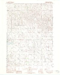
White Thunder Creek carves a winding path through the northern plains of South Dakota, serving as the central drainage for a landscape defined by ranching and reservation land. The 1982 map highlights the intricate relationship between tribal and county jurisdictions, showing the Rosebud Indian Reservation Boundary as it bisects the terrain alongside the Mellette and Todd County line.
Find a feature on this map
19 named features on this map. Tap any name to fly to it.
Don’t see what you’re looking for? This feature index may not catch every label — zoom into the map to look around manually.
Map Details
Editions of this 1982 Mission NE Map
This is the sole edition of this map. No revisions or reprints were ever made.
Other maps of this area

1955 · Martin
USGS Topo · 1:250,000

1958 · Martin
USGS Topo · 1:250,000

1969 · Mission NW
USGS Topo · 1:24,000

1969 · Mission
USGS Topo · 1:24,000

1982 · White River SE
USGS Topo · 1:24,000

1982 · Wood North
USGS Topo · 1:24,000

1982 · White River East
USGS Topo · 1:24,000

1982 · Okreek
USGS Topo · 1:25,000
1982 · Mission SE
USGS Topo · 1:24,000
1982 · Wood South
USGS Topo · 1:24,000