
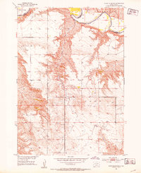
1982 Map of White River East
USGS Topo · Published 1982About this map
The Little White River meanders through this landscape in Mellette County, following a winding course that defines the local topography. This 1982 provisional survey shows the community of White River situated near the intersection of Highway 83. The area's ranching economy is clearly documented through numerous named family operations, such as the Hutchinson Ranch and Clifford Hight Ranch, which are spread across the plains and river breaks.
Find a feature on this map
19 named features on this map. Tap any name to fly to it.
Don’t see what you’re looking for? This feature index may not catch every label — zoom into the map to look around manually.
Map Details
Editions of this 1982 White River East Map
This is the sole edition of this map. No revisions or reprints were ever made.
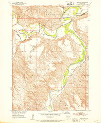
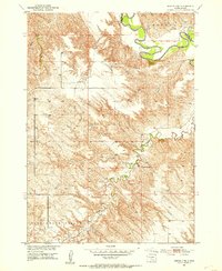
Other maps of this area
1951 · White River NE
USGS Topo · 1:24,000
1951 · Westover
USGS Topo · 1:24,000
1951 · Murdo 3 NE
USGS Topo · 1:24,000

1955 · Martin
USGS Topo · 1:250,000

1958 · Martin
USGS Topo · 1:250,000

1969 · Soldier Creek NE
USGS Topo · 1:24,000

1969 · Mission NW
USGS Topo · 1:24,000

1982 · Mission NE
USGS Topo · 1:24,000

1982 · White River SE
USGS Topo · 1:24,000

1982 · White River West
USGS Topo · 1:24,000
Featured Places
- White River, SD
- Swift Bear Segment, SD
- Horse Creek Segment, SD
- Horse Creek, Horse Creek Segment
- Butte Creek Segment, SD