
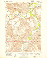
1982 Map of White River West
USGS Topo · Published 1982About this map
White River serves as the focal point for this ranching landscape in Mellette County during the early 1980s. The map illustrates a community defined by vast family-held lands, including the Jensen Ranch, Stromer Ranch, and Gary Astleford Ranch, which populate the high ground above the river valleys. A notable industrial presence is seen near the settlement of White River, where a Concrete Dam Spillway, Small Power Plant, and several Pump Houses indicate the infrastructure required for water and power management in this prairie environment.
Find a feature on this map
26 named features on this map. Tap any name to fly to it.
Don’t see what you’re looking for? This feature index may not catch every label — zoom into the map to look around manually.
Map Details
Editions of this 1982 White River West Map
This is the sole edition of this map. No revisions or reprints were ever made.
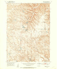
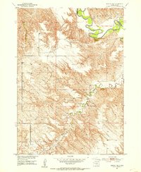
Other maps of this area
1951 · Westover
USGS Topo · 1:24,000
1951 · Murdo 3 NW
USGS Topo · 1:24,000
1951 · Murdo 3 NE
USGS Topo · 1:24,000

1955 · Martin
USGS Topo · 1:250,000

1958 · Martin
USGS Topo · 1:250,000

1969 · Soldier Creek NE
USGS Topo · 1:24,000

1969 · Mission NW
USGS Topo · 1:24,000

1969 · Soldier Creek NW
USGS Topo · 1:24,000
1982 · Murdo 3 NW
USGS Topo · 1:25,000

1982 · White River East
USGS Topo · 1:24,000