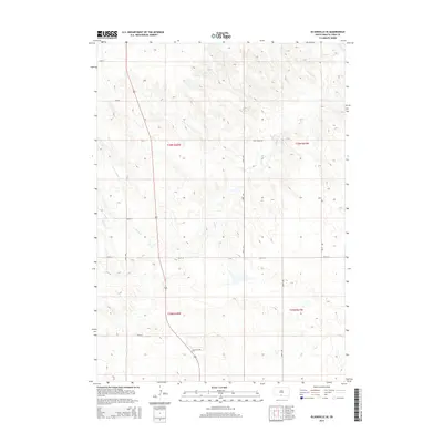
2015 Map of Olsonville SE
USGS Topo · Published 2015About this map
The waters of Rock Cr carve a meandering path through this section of Todd County, defining the drainage patterns in a landscape structured by the Public Land Survey System. Located within the Antelope Segment, the map area is predominantly defined by its rural grid, with long stretches of gravel and local roads like Rock Creek Rd and 296th St providing access across the township lines of T36N and T35N.
Find a feature on this map
16 named features on this map. Tap any name to fly to it.
Don’t see what you’re looking for? This feature index may not catch every label — zoom into the map to look around manually.
Map Details
Editions of this 2015 Olsonville SE Map
This is the sole edition of this map. No revisions or reprints were ever made.
Other maps of this area
1950 · Sparks
USGS Topo · 1:62,500
1950 · Valentine
USGS Topo · 1:62,500
1955 · Martin
USGS Topo · 1:250,000
1957 · Valentine
USGS Topo · 1:250,000
1958 · Martin
USGS Topo · 1:250,000
1959 · Valentine
USGS Topo · 1:250,000
1969 · Olsonville NW
USGS Topo · 1:24,000
1969 · Olsonville SW
USGS Topo · 1:24,000
1982 · Olsonville
USGS Topo · 1:24,000
1982 · Olsonville SE
USGS Topo · 1:24,000
Featured Places
- Antelope Segment, SD
- Rosebud, Antelope Segment
- Sicangu Village, Antelope Segment
- Todd County, SD
- United States