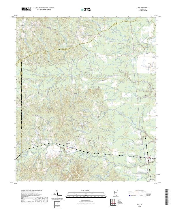
2024 Map of Oma
USGS Topo · Published 2024About this map
Bahala Creek and Little Bahala Creek carve through the center of this Mississippi landscape, which sits at the meeting point of Copiah, Lawrence, and Lincoln counties. The small settlements of Oma, Sontag, Wanilla, and Tryus are connected by a network of rural routes such as Smith Ferry Rd and Monticello Rd, reflecting a dispersed agricultural and timber-based community structure.
Find a feature on this map
68 named features on this map. Tap any name to fly to it.
Don’t see what you’re looking for? This feature index may not catch every label — zoom into the map to look around manually.
Map Details
Editions of this 2024 Oma Map
This is the sole edition of this map. No revisions or reprints were ever made.
Other maps of this area

1953 · Natchez
USGS Topo · 1:250,000

1956 · Natchez
USGS Topo · 1:250,000

1959 · Natchez
USGS Topo · 1:250,000

1963 · Shady Grove
USGS Topo · 1:24,000

1970 · Monticello
USGS Topo · 1:24,000

1970 · Nola
USGS Topo · 1:24,000

1971 · Schley
USGS Topo · 1:24,000
1971 · Monticello NE
USGS Topo · 1:24,000

1971 · Oma
USGS Topo · 1:24,000
1971 · Georgetown
USGS Topo · 1:24,000