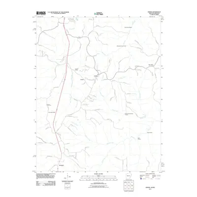
2011 Map of Omaha
USGS Topo · Published 2011About this map
Omaha stands as a central community in this 2011 survey, situated within a landscape defined by deeply carved hollows and prominent ridges near the Arkansas-Missouri border. The settlement pattern follows the high ground and creek valleys, with smaller communities like Cricket and New Hope connected by a network of rural roads such as Old Springfield Rd and Dubuque Rd. The topography is particularly diverse, ranging from the heights of Cloverdale Ridge to the low reaches of Blowing Spring Hollow and Groverware Spring Hollow.
Find a feature on this map
90 named features on this map. Tap any name to fly to it.
Don’t see what you’re looking for? This feature index may not catch every label — zoom into the map to look around manually.
Map Details
Editions of this 2011 Omaha Map
This is the sole edition of this map. No revisions or reprints were ever made.
Other maps of this area

1904 · Harrison
USGS Topo · 1:125,000

1905 · Harrison
USGS Topo · 1:125,000

1907 · Forsyth
USGS Topo · 1:125,000

1945 · Harrison
USGS Topo · 1:250,000

1949 · Harrison
USGS Topo · 1:250,000

1954 · Harrison
USGS Topo · 1:250,000

1956 · Table Rock Dam
USGS Topo · 1:24,000
1956 · Mincy
USGS Topo · 1:24,000
1956 · Hollister
USGS Topo · 1:24,000

1958 · Harrison
USGS Topo · 1:250,000