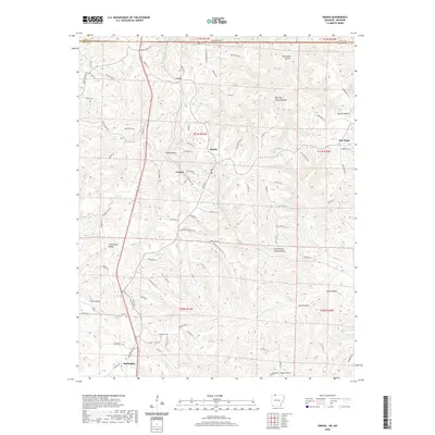
2020 Map of Omaha
USGS Topo · Published 2020About this map
Omaha and the surrounding high country of Boone County define the landscape of this Arkansas-Missouri borderland. Located just south of the state line, the community is the central hub for several small settlements including Crest to the north, Cricket to the southwest, and New Hope near the eastern margin. The terrain is deeply carved by a network of drainage systems, most notably Cricket Cr and the winding Barren Fork, which have created numerous deep hollows such as Burchman Hollow and McGill Hollow.
Find a feature on this map
96 named features on this map. Tap any name to fly to it.
Don’t see what you’re looking for? This feature index may not catch every label — zoom into the map to look around manually.
Map Details
Editions of this 2020 Omaha Map
This is the sole edition of this map. No revisions or reprints were ever made.
Other maps of this area

1904 · Harrison
USGS Topo · 1:125,000

1905 · Harrison
USGS Topo · 1:125,000

1907 · Forsyth
USGS Topo · 1:125,000

1945 · Harrison
USGS Topo · 1:250,000

1949 · Harrison
USGS Topo · 1:250,000

1954 · Harrison
USGS Topo · 1:250,000

1956 · Table Rock Dam
USGS Topo · 1:24,000
1956 · Mincy
USGS Topo · 1:24,000
1956 · Hollister
USGS Topo · 1:24,000

1958 · Harrison
USGS Topo · 1:250,000