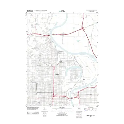
2011 Map of Omaha North
USGS Topo · Published 2011About this map
The Missouri River carves a winding path between Omaha, Nebraska, and Council Bluffs, Iowa, defining the industrial and civic heart of the region. This 2011 survey illustrates the dense urban infrastructure of Omaha, including the expansive Creighton University campus and the University of Nebraska Medical Center. The landscape is notably dense with historical burial grounds, such as the Mormon Cemetery, Forest Lawn Cemetery, and Prospect Hill Cemetery, which serve as quiet landmarks among the city's residential expansions like Garden Valley Courts and Beechwood. Along the riverbanks, the Mormon Bridge and Ak Sar Ben Bridge facilitate interstate travel, while the proximity of Eppley Airfield and the Council Bluffs Levee Unit highlights the intersection of transportation and environmental management. This period shows a mature metropolitan area defined by its relationship with the river and its preservation of significant genealogical sites.
Find a feature on this map
113 named features on this map. Tap any name to fly to it.
Don’t see what you’re looking for? This feature index may not catch every label — zoom into the map to look around manually.
Map Details
Editions of this 2011 Omaha North Map
This is the sole edition of this map. No revisions or reprints were ever made.
Other maps of this area

1893 · Omaha
USGS Topo · 1:62,500

1893 · Fremont
USGS Topo · 1:125,000

1896 · Fremont
USGS Topo · 1:125,000

1954 · Omaha
USGS Topo · 1:250,000

1955 · Fremont
USGS Topo · 1:250,000

1956 · Ralston
USGS Topo · 1:24,000

1956 · Irvington
USGS Topo · 1:24,000

1956 · Council Bluffs North
USGS Topo · 1:24,000

1956 · Omaha North
USGS Topo · 1:24,000

1956 · Council Bluffs South
USGS Topo · 1:24,000