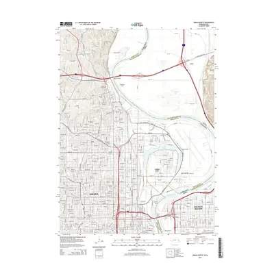
2014 Map of Omaha North
USGS Topo · Published 2014About this map
Omaha and Council Bluffs are anchored by the winding Missouri River, which creates a complex interstate boundary between Nebraska and Iowa. The river's path is defined by sharp meanders such as Florence Bend and Council Bend, with the oxbow of Carter Lake sitting as a geographic anomaly west of the main channel. This 2014 survey reveals the dense urban grid of the riverfront, emphasizing significant local institutions like Creighton Univ and the Metropolitan Community Coll Area.
Find a feature on this map
182 named features on this map. Tap any name to fly to it.
Don’t see what you’re looking for? This feature index may not catch every label — zoom into the map to look around manually.
Map Details
Editions of this 2014 Omaha North Map
This is the sole edition of this map. No revisions or reprints were ever made.
Other maps of this area

1893 · Omaha
USGS Topo · 1:62,500

1893 · Fremont
USGS Topo · 1:125,000

1896 · Fremont
USGS Topo · 1:125,000

1954 · Omaha
USGS Topo · 1:250,000

1955 · Fremont
USGS Topo · 1:250,000

1956 · Ralston
USGS Topo · 1:24,000

1956 · Irvington
USGS Topo · 1:24,000

1956 · Council Bluffs North
USGS Topo · 1:24,000

1956 · Omaha North
USGS Topo · 1:24,000

1956 · Council Bluffs South
USGS Topo · 1:24,000