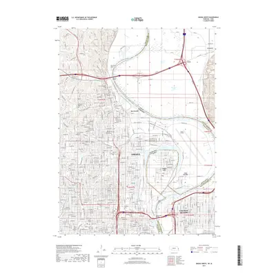
2017 Map of Omaha North
USGS Topo · Published 2017About this map
Omaha and Council Bluffs anchor this 2017 survey, revealing a landscape defined by the shifting course of the Missouri River. The state boundary between Nebraska and Iowa follows the ancient oxbows of the river, leaving Carter Lake and its namesake community on the Nebraska side of the water despite their Iowa jurisdiction. This complex riverine border is further marked by features like The Narrows and Council Bend, showing how the waterway's historical movement has dictated modern geography.
Find a feature on this map
70 named features on this map. Tap any name to fly to it.
Don’t see what you’re looking for? This feature index may not catch every label — zoom into the map to look around manually.
Map Details
Editions of this 2017 Omaha North Map
This is the sole edition of this map. No revisions or reprints were ever made.
Other maps of this area

1893 · Omaha
USGS Topo · 1:62,500

1893 · Fremont
USGS Topo · 1:125,000

1896 · Fremont
USGS Topo · 1:125,000

1954 · Omaha
USGS Topo · 1:250,000

1955 · Fremont
USGS Topo · 1:250,000

1956 · Ralston
USGS Topo · 1:24,000

1956 · Irvington
USGS Topo · 1:24,000

1956 · Council Bluffs North
USGS Topo · 1:24,000

1956 · Omaha North
USGS Topo · 1:24,000

1956 · Council Bluffs South
USGS Topo · 1:24,000