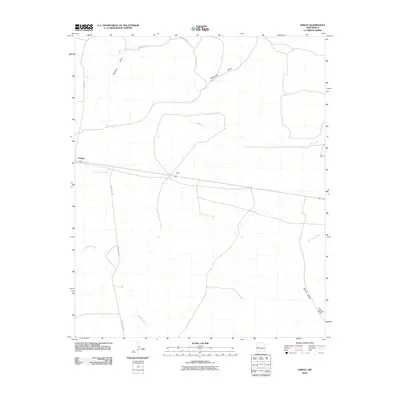
2010 Map of Omega
USGS Topo · Published 2010About this map
Omega and the small settlement of Bates anchor this portion of Catron County, where the high desert landscape is defined by a network of drainage draws and perennial watercourses. The drainage patterns of San Ignacio Creek and Mangas Creek dominate the central and southern sections, illustrating the hydrologic reliance of this arid region on natural watershed features. Local transportation is represented by a mix of established routes like Omega Rd and County Rd A95, alongside smaller residential ways such as Quarter Horse Ct. To the north, the terrain is marked by deep topographic features including Sweazea Draw and McAllister Draw, while the eastern edge shows the quiet presence of Hickey. This survey provides a spatial record of small ranching or residential outposts connected by long-distance county roads and the winding paths of seasonal creeks.
Find a feature on this map
14 named features on this map. Tap any name to fly to it.
Don’t see what you’re looking for? This feature index may not catch every label — zoom into the map to look around manually.
Map Details
Editions of this 2010 Omega Map
This is the sole edition of this map. No revisions or reprints were ever made.
Other maps of this area

1954 · Saint Johns
USGS Topo · 1:250,000

1957 · Saint Johns
USGS Topo · 1:250,000

1958 · Saint Johns
USGS Topo · 1:250,000

1962 · Saint Johns
USGS Topo · 1:250,000

1967 · Omega
USGS Topo · 1:24,000

1967 · Mariano Springs
USGS Topo · 1:24,000

1967 · Adams Diggings
USGS Topo · 1:24,000

1967 · Blue Hills
USGS Topo · 1:24,000
1967 · Pie Town
USGS Topo · 1:24,000

1967 · Quemado
USGS Topo · 1:24,000