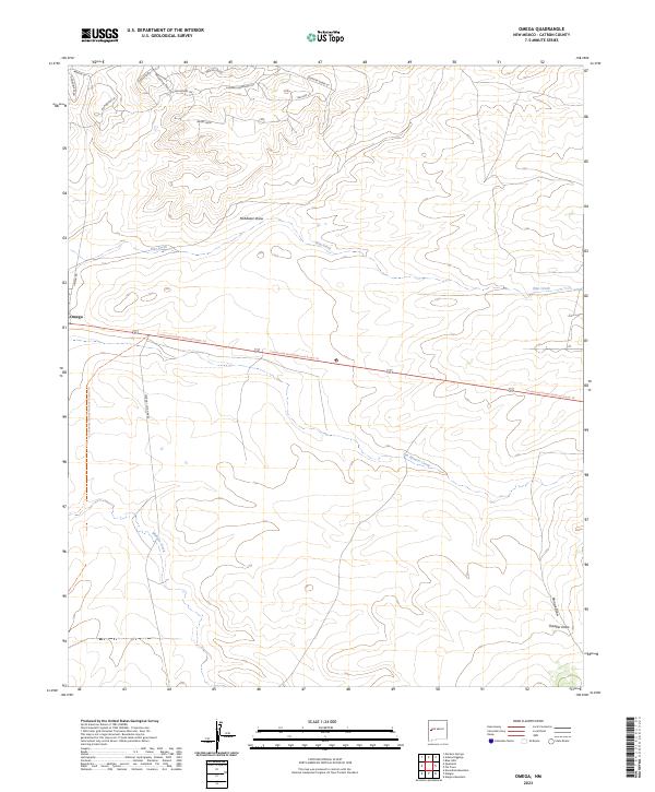
2023 Map of Omega
USGS Topo · Published 2023About this map
The small settlement of Omega serves as the focal point for this high-desert landscape in western New Mexico. This 2023 survey illustrates a region where the Continental Divide National Scenic Trl bisects the terrain, tracing a path across the divide between the high plains and rugged draws. Local transportation is defined by rural routes like Catron Co Rd A095 and a network of roads reflecting the area's equestrian character, including Bridle Path and Golden Horseshoe Trl.
Find a feature on this map
28 named features on this map. Tap any name to fly to it.
Don’t see what you’re looking for? This feature index may not catch every label — zoom into the map to look around manually.
Map Details
Editions of this 2023 Omega Map
This is the sole edition of this map. No revisions or reprints were ever made.
Other maps of this area

1954 · Saint Johns
USGS Topo · 1:250,000

1957 · Saint Johns
USGS Topo · 1:250,000

1958 · Saint Johns
USGS Topo · 1:250,000

1962 · Saint Johns
USGS Topo · 1:250,000

1967 · Omega
USGS Topo · 1:24,000

1967 · Mariano Springs
USGS Topo · 1:24,000

1967 · Adams Diggings
USGS Topo · 1:24,000

1967 · Blue Hills
USGS Topo · 1:24,000
1967 · Pie Town
USGS Topo · 1:24,000

1967 · Quemado
USGS Topo · 1:24,000