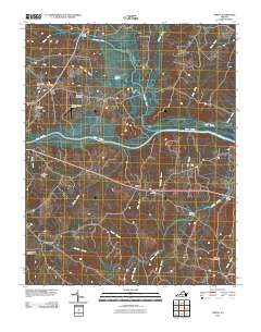
2010 Map of Omega
USGS Topo · Published 2010About this map
The Dan River and Hyco River converge in this Southern Virginia landscape, defining a region where water and transport have long shaped the local economy. At the heart of the area, the settlement of Omega sits along a primary road corridor, while nearby Five Forks and Wolf Trap serve as key landmarks in the rural geography. The map reveals a transition between agricultural land and regional infrastructure, featuring the William M Tuck Airport and the South Boston Speedway near the western edge.
Find a feature on this map
34 named features on this map. Tap any name to fly to it.
Don’t see what you’re looking for? This feature index may not catch every label — zoom into the map to look around manually.
Map Details
Editions of this 2010 Omega Map
This is the sole edition of this map. No revisions or reprints were ever made.
Other maps of this area

1941 · Clarksville
USGS Topo · 1:48,000

1943 · Clarksville
USGS Topo · 1:62,500

1953 · South Boston
USGS Topo · 1:62,500

1953 · Greensboro
USGS Topo · 1:250,000

1954 · Greensboro
USGS Topo · 1:250,000

1954 · Clover
USGS Topo · 1:62,500

1954 · Halifax
USGS Topo · 1:62,500

1957 · South Boston
USGS Topo · 1:62,500

1957 · Clarksville
USGS Topo · 1:62,500

1962 · Greensboro
USGS Topo · 1:250,000