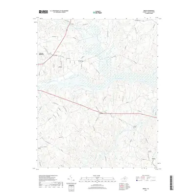
2019 Map of Omega
USGS Topo · Published 2019About this map
The Dan River and Banister River converge in this section of Halifax County, defining a landscape of deep river bends and rural crossroads. The area around Omega and Wolf Trap reflects a settlement pattern tied to these waterways and the high ground between them, where long-established family farms and community centers persist. Genealogists will find several notable burial sites throughout the terrain, including Five Forks Cem, Ebenezer Cem, and the White Oak Fork Cem near Moffett. Transport in the region is anchored by the William M Tuck Airport and several historic crossing points such as Griffins Bridge and Terrys Bridge, which connect the scattered hamlets across the winding hydrography of Gibson Cr, Wolf Trap Cr, and the Hyco River.
Find a feature on this map
79 named features on this map. Tap any name to fly to it.
Don’t see what you’re looking for? This feature index may not catch every label — zoom into the map to look around manually.
Map Details
Editions of this 2019 Omega Map
This is the sole edition of this map. No revisions or reprints were ever made.
Other maps of this area

1941 · Clarksville
USGS Topo · 1:48,000

1943 · Clarksville
USGS Topo · 1:62,500

1953 · South Boston
USGS Topo · 1:62,500

1953 · Greensboro
USGS Topo · 1:250,000

1954 · Greensboro
USGS Topo · 1:250,000

1954 · Clover
USGS Topo · 1:62,500

1954 · Halifax
USGS Topo · 1:62,500

1957 · South Boston
USGS Topo · 1:62,500

1957 · Clarksville
USGS Topo · 1:62,500

1962 · Greensboro
USGS Topo · 1:250,000