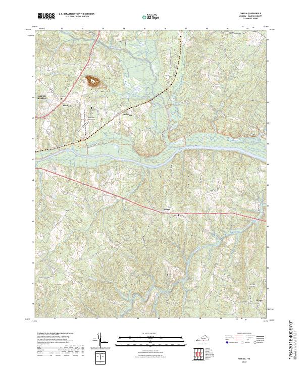
2022 Map of Omega
USGS Topo · Published 2022About this map
The Dan River and Banister River converge in this corner of Halifax County, defining a landscape of riparian bottomlands and rising ridges. The settlement at Wolf Trap sits just north of the riverbend, while the community of Omega serves as a central point along the southern road network. Local transportation history is visible in the alignment of the Tobacco Heritage Trl, which follows former rail corridors through the terrain. Significant genealogical markers are scattered throughout the area, including the Five Forks Cem, Ebenezer Cem, and White Oak Fork Cem. Aviation history is represented by the William M Tuck Airport situated west of Wolf Trap. The map also captures the smaller residential clusters of Five Forks and Moffett, alongside the complex drainage systems of Wolf Trap Cr and the Hyco River.
Find a feature on this map
73 named features on this map. Tap any name to fly to it.
Don’t see what you’re looking for? This feature index may not catch every label — zoom into the map to look around manually.
Map Details
Editions of this 2022 Omega Map
This is the sole edition of this map. No revisions or reprints were ever made.
Other maps of this area

1941 · Clarksville
USGS Topo · 1:48,000

1943 · Clarksville
USGS Topo · 1:62,500

1953 · South Boston
USGS Topo · 1:62,500

1953 · Greensboro
USGS Topo · 1:250,000

1954 · Greensboro
USGS Topo · 1:250,000

1954 · Clover
USGS Topo · 1:62,500

1954 · Halifax
USGS Topo · 1:62,500

1957 · South Boston
USGS Topo · 1:62,500

1957 · Clarksville
USGS Topo · 1:62,500

1962 · Greensboro
USGS Topo · 1:250,000