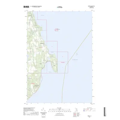
2023 Map of Omena
USGS Topo · Published 2023About this map
Omena and Peshawbestown occupy a scenic portion of the Leelanau Peninsula, where the land narrows between Bass Lake and the waters of Grand Traverse Bay. The local geography is defined by prominent coastal features like Omena Point and the isolated Bellow Island out in the bay. Roads such as N West Bay Shore Dr follow the contour of the shoreline, connecting historic communities and religious sites including the Omena Presbyterian Cem and the Immaculate Conception Catholic Cem.
Find a feature on this map
54 named features on this map. Tap any name to fly to it.
Don’t see what you’re looking for? This feature index may not catch every label — zoom into the map to look around manually.
Map Details
Editions of this 2023 Omena Map
This is the sole edition of this map. No revisions or reprints were ever made.
Other maps of this area

1954 · Central Lake
USGS Topo · 1:62,500

1954 · Traverse City
USGS Topo · 1:250,000

1955 · Cheboygan
USGS Topo · 1:250,000

1957 · Traverse City
USGS Topo · 1:62,500

1957 · Northport
USGS Topo · 1:62,500

1957 · Elk Rapids
USGS Topo · 1:62,500

1958 · Cheboygan
USGS Topo · 1:250,000

1958 · Traverse City
USGS Topo · 1:250,000

1983 · Northport
USGS Topo · 1:25,000

1983 · Omena
USGS Topo · 1:24,000