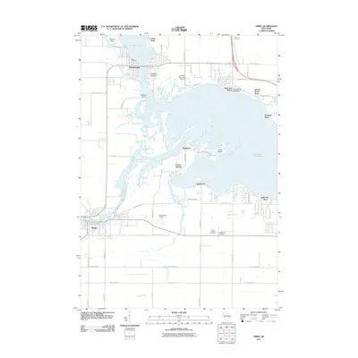
2011 Map of Omro
USGS Topo · Published 2011About this map
The Wolf River and Fox River converge in this Winnebago County landscape, creating a complex network of waterways that define the settlements of Winneconne and Omro. By the early 21st century, the shoreline of Lake Butte des Morts had become densely populated with residential developments such as Highland Shore, Rivermoor, and Nichols Shore Acres. This map illustrates how the historic river-reliant communities adapted to the modern era, with small aviation facilities like the Sky Diving Airport and Courtney Plummer Airport situated alongside traditional agricultural tracts.
Find a feature on this map
59 named features on this map. Tap any name to fly to it.
Don’t see what you’re looking for? This feature index may not catch every label — zoom into the map to look around manually.
Map Details
Editions of this 2011 Omro Map
This is the sole edition of this map. No revisions or reprints were ever made.
Other maps of this area

1916 · Ripon
USGS Topo · 1:48,000

1918 · Ripon
USGS Topo · 1:62,500

1955 · Green Bay
USGS Topo · 1:250,000

1956 · Ripon
USGS Topo · 1:62,500

1956 · Rosendale
USGS Topo · 1:62,500

1957 · Madison
USGS Topo · 1:250,000

1960 · Madison
USGS Topo · 1:250,000

1961 · Oshkosh
USGS Topo · 1:24,000

1961 · Poy Sippi
USGS Topo · 1:62,500

1961 · Oshkosh
USGS Topo · 1:62,500