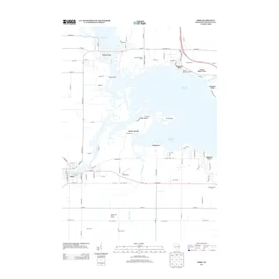
2013 Map of Omro
USGS Topo · Published 2013About this map
The Wolf River and Fox River systems define this Winnebago County landscape, where water-oriented settlements like Winneconne and Omro have long served as regional hubs. The geography is dominated by the expanse of Lake Butte des Morts and Lake Winneconne, separated by the narrowing at Quigleys Point. While the towns provide a traditional grid-based core, the shoreline is punctuated by specialized communities and landmarks including Rivermoor, Reighmoor, and Terrell Island. The area's modern identity is shaped by a mix of aviation and agriculture, evident in the presence of the Courtney Plummer Airport and the Sky Diving Airport alongside established agricultural sites like Remer Farms and Deja Vu Farm. This 2013 survey illustrates the continued importance of the river corridors for both transport and residential development in East Central Wisconsin.
Find a feature on this map
92 named features on this map. Tap any name to fly to it.
Don’t see what you’re looking for? This feature index may not catch every label — zoom into the map to look around manually.
Map Details
Editions of this 2013 Omro Map
This is the sole edition of this map. No revisions or reprints were ever made.
Other maps of this area

1916 · Ripon
USGS Topo · 1:48,000

1918 · Ripon
USGS Topo · 1:62,500

1955 · Green Bay
USGS Topo · 1:250,000

1956 · Ripon
USGS Topo · 1:62,500

1956 · Rosendale
USGS Topo · 1:62,500

1957 · Madison
USGS Topo · 1:250,000

1960 · Madison
USGS Topo · 1:250,000

1961 · Oshkosh
USGS Topo · 1:24,000

1961 · Poy Sippi
USGS Topo · 1:62,500

1961 · Oshkosh
USGS Topo · 1:62,500