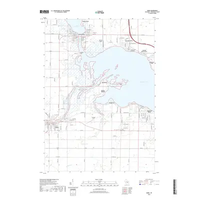
2018 Map of Omro
USGS Topo · Published 2018About this map
Winneconne sits at the strategic bottleneck where the Wolf River flows from Lake Winneconne into the expansive Lake Butte des Morts. The landscape is dominated by the complex aquatic ecosystems of the upper Fox River waterway, including the significant Nickels Marsh and landmarks like Terrell Island. The settlement pattern in 2018 reflects a blend of historic town centers and waterfront developments such as Rivermoor, Harbor Springs, and Highland Shore. In the southern portion of the sheet, the city of Omro stands along the Fox River, serving as a gateway to the surrounding agricultural plains. Local history and genealogy are anchored by features such as the Omro Union Cem and the Town Cem near Winneconne. The presence of specialized infrastructure like the Sky Diving Airport and Courtney Plummer Airport underscores the area's modern role as a hub for both aviation and water-based recreation.
Find a feature on this map
99 named features on this map. Tap any name to fly to it.
Don’t see what you’re looking for? This feature index may not catch every label — zoom into the map to look around manually.
Map Details
Editions of this 2018 Omro Map
This is the sole edition of this map. No revisions or reprints were ever made.
Other maps of this area

1916 · Ripon
USGS Topo · 1:48,000

1918 · Ripon
USGS Topo · 1:62,500

1955 · Green Bay
USGS Topo · 1:250,000

1956 · Ripon
USGS Topo · 1:62,500

1956 · Rosendale
USGS Topo · 1:62,500

1957 · Madison
USGS Topo · 1:250,000

1960 · Madison
USGS Topo · 1:250,000

1961 · Oshkosh
USGS Topo · 1:24,000

1961 · Poy Sippi
USGS Topo · 1:62,500

1961 · Oshkosh
USGS Topo · 1:62,500