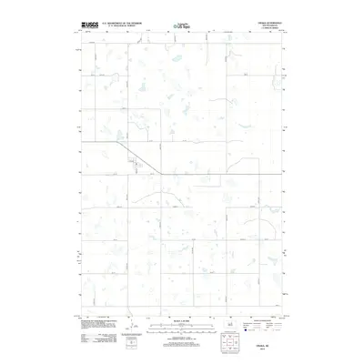
2012 Map of Onaka
USGS Topo · Published 2012About this map
Onaka serves as the central hub of this Faulk County landscape, situated at the intersection of Main St and 1st Ave. The settlement pattern reflects the traditional grid-like organization of the Great Plains, where section lines dictate the placement of local roads like 334th Ave and 148th St. Numerous small, scattered water bodies dot the terrain, illustrating the glacial prairie pothole topography characteristic of the region. This 2012 survey captures the area's rural character, dominated by agricultural land use and a structured network of numbered routes such as 150 St and 338th Ave that connect isolated farmsteads. The concentration of structures remains focused within the village limits, while the surrounding territory is defined by the repetitive intervals of the township and range survey system, ending at 156 St along the southern boundary.
Find a feature on this map
19 named features on this map. Tap any name to fly to it.
Don’t see what you’re looking for? This feature index may not catch every label — zoom into the map to look around manually.
Map Details
Editions of this 2012 Onaka Map
This is the sole edition of this map. No revisions or reprints were ever made.
Other maps of this area

1950 · Onaka
USGS Topo · 1:24,000

1951 · Clark Lake
USGS Topo · 1:24,000

1952 · Onaka
USGS Topo · 1:24,000

1952 · Burkmere
USGS Topo · 1:24,000

1952 · Onaka SW
USGS Topo · 1:24,000

1954 · Aberdeen
USGS Topo · 1:250,000

1956 · Aberdeen
USGS Topo · 1:250,000

1965 · Onaka
USGS Topo · 1:24,000

1974 · Bowdle SE
USGS Topo · 1:24,000

1974 · Roscoe SW
USGS Topo · 1:24,000