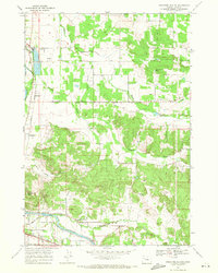
1969 Map of Onehorse Slough
USGS Topo · Published 1971About this map
The South Santiam River winds through the southern portion of this Linn County landscape, serving as a focal point for local industry and infrastructure. Near the river's edge, the Lebanon Dam and Hamilton Creek School sit close to the small settlement of Berlin. This area is defined by a transition from flat agricultural land in the west to the more complex topography of Golden Valley and the prominent Ridgeway Butte in the south.
Find a feature on this map
30 named features on this map. Tap any name to fly to it.
Don’t see what you’re looking for? This feature index may not catch every label — zoom into the map to look around manually.
Map Details
Editions of this 1969 Onehorse Slough Map
2 editions found
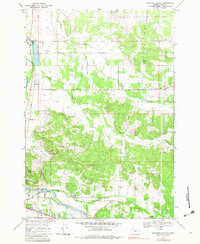
Other maps of this area

1911 · Brownsville
USGS Topo · 1:31,680

1911 · Lebanon
USGS Topo · 1:31,680

1921 · Brownsville
USGS Topo · 1:62,500

1921 · Lebanon
USGS Topo · 1:62,500

1922 · Lebanon
USGS Topo · 1:48,000

1924 · Lebanon
USGS Topo · 1:62,500

1940 · Lebanon
USGS Topo · 1:62,500

1944 · Lebanon
USGS Topo · 1:62,500

1950 · Brownsville
USGS Topo · 1:62,500

1951 · Sweet Home
USGS Topo · 1:62,500