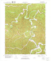
1979 Map of Oneida
USGS Topo · Published 1979About this map
Oneida sits at the convergence of Goose Creek and Bullskin Creek, dominated by the presence of the Oneida Baptist Institute. The landscape of this Eastern Kentucky region in the late 1970s is defined by the winding course of the South Fork Kentucky River, which carves deep valleys through the plateau. Small settlements like Ammie, Trixie, and Taft are scattered across the terrain, often located at the mouths of branches or gaps such as Felty Gap. The map documents a complex network of resource extraction and infrastructure, indicated by numerous Gas Wells and several Strip Mines. Local family history is well-preserved through numerous small burial grounds, including the Sizemore Cem, Bishop Cem, and Williams Cem, reflecting the genealogical deep roots of this Clay and Owsley County borderland.
Find a feature on this map
70 named features on this map. Tap any name to fly to it.
Don’t see what you’re looking for? This feature index may not catch every label — zoom into the map to look around manually.
Map Details
Editions of this 1979 Oneida Map
This is the sole edition of this map. No revisions or reprints were ever made.
Other maps of this area

1891 · Manchester
USGS Topo · 1:125,000

1952 · Manchester
USGS Topo · 1:24,000

1953 · Oneida
USGS Topo · 1:24,000

1953 · Cowcreek
USGS Topo · 1:24,000

1953 · Big Creek
USGS Topo · 1:24,000

1953 · Mistletoe
USGS Topo · 1:24,000

1953 · Booneville
USGS Topo · 1:24,000

1953 · Sturgeon
USGS Topo · 1:24,000

1954 · Barcreek
USGS Topo · 1:24,000

1954 · Maulden
USGS Topo · 1:24,000