
Loading...
Loading map...2023 Map of Oneida
USGS Topo · Published 2023About this map
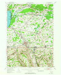
Oneida and its surrounding Madison County hamlets are detailed in this contemporary look at a landscape defined by historic settlement patterns and the drainage of Oneida Creek. The local seat of government at Wampsville is anchored by the Madison County Courthouse, while smaller communities like Oneida Castle, Durhamville, and Lenox Basin follow the established road and water corridors.
Find a feature on this map
145 named features on this map. Tap any name to fly to it.
Don’t see what you’re looking for? This feature index may not catch every label — zoom into the map to look around manually.
Map Details
Date Portrayed2023
Date Published2023
PublisherU.S. Geological Survey
Map TypeTopographic
Scale1:24000
Physical Dimensions24 x 29 inches
Editions of this 2023 Oneida Map
This is the sole edition of this map. No revisions or reprints were ever made.
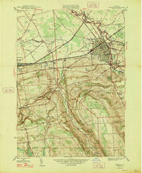
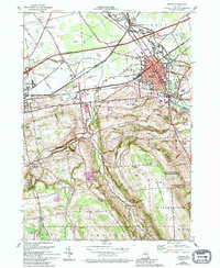
Historical Maps of Oneida Castle Through Time
8 maps found


Featured Locations
Source Details
SourceU.S. Geological Survey
CopyrightPublic Domain