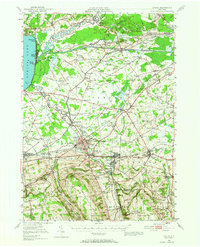
1946 Map of Oneida
USGS Topo · Published 1965About this map
Oneida Lake and the Erie Canal anchor this mid-1940s landscape, where water-based commerce and recreation meet at the eastern shore. The shoreline is bustling with seasonal and permanent settlements from North Bay down to Sylvan Beach and Verona Beach, the latter guarded by the Verona Beach Light. Further inland, the infrastructure of the New York Central and the Turnpike serves a network of small agricultural and industrial hamlets.
Find a feature on this map
117 named features on this map. Tap any name to fly to it.
Don’t see what you’re looking for? This feature index may not catch every label — zoom into the map to look around manually.
Map Details
Editions of this 1946 Oneida Map
Other maps of this area

1895 · Chittenango
USGS Topo · 1:62,500

1895 · Oriskany
USGS Topo · 1:62,500

1895 · Oneida
USGS Topo · 1:62,500

1897 · Cazenovia
USGS Topo · 1:62,500

1898 · Oneida
USGS Topo · 1:62,500

1898 · Chittenango
USGS Topo · 1:62,500

1898 · Oriskany
USGS Topo · 1:62,500

1899 · Cazenovia
USGS Topo · 1:62,500

1902 · Chittenango
USGS Topo · 1:62,500

1902 · Morrisville
USGS Topo · 1:62,500