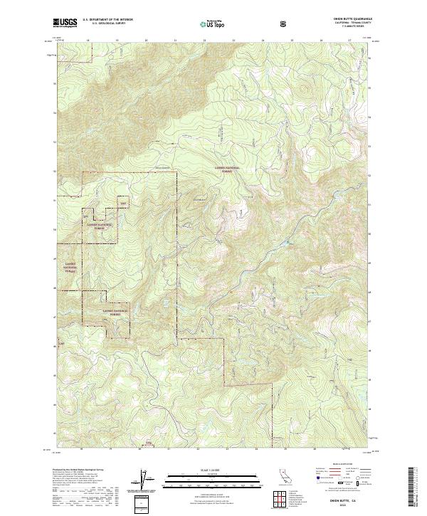
2022 Map of Onion Butte
USGS Topo · Published 2022About this map
Lassen National Forest dominates this high-altitude landscape in Tehama County, where the historic Lassen Trail snakes through the northern sections near Round Valley. This territory is defined by its complex drainage systems and significant elevation changes, anchored by landmarks such as Onion Butte and Onion Summit. The southern reaches of the map are particularly notable for the Colby Mtn Lookout situated atop Colby Mtn, overlooking the headwaters of Colby Cr and S Fork Calf Cr. Along the corridor of Ca 32, the terrain drops sharply toward the water, marked by the presence of Deer Creek Falls and Lower Deer Creek Falls. The presence of labels like Peckerwood and various family or descriptive names for remote creeks provides a glimpse into the nomenclature of this protected wilderness during the early 21st century.
Find a feature on this map
38 named features on this map. Tap any name to fly to it.
Don’t see what you’re looking for? This feature index may not catch every label — zoom into the map to look around manually.
Map Details
Editions of this 2022 Onion Butte Map
This is the sole edition of this map. No revisions or reprints were ever made.
Other maps of this area

1886 · Lassen Peak
USGS Topo · 1:250,000

1892 · Lassen Peak
USGS Topo · 1:250,000

1894 · Lassen Peak
USGS Topo · 1:250,000

1935 · Paynes Creek
USGS Topo · 1:96,000

1941 · Mineral
USGS Topo · 1:125,000

1955 · Westwood
USGS Topo · 1:250,000

1956 · Lassen Peak
USGS Topo · 1:62,500

1956 · Mt. Harkness
USGS Topo · 1:62,500

1958 · Westwood
USGS Topo · 1:250,000

1958 · Jonesville
USGS Topo · 1:62,500