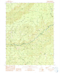
1991 Map of Onion Butte
USGS Topo · Published 1991About this map
Lassen National Forest terrain dominates this 1991 provisional survey, which highlights the complex drainage systems and high-altitude landmarks of Tehama County. The landscape is centered on the prominent Colby Mountain and the high point of Onion Summit, with the Colby Lookout Tower providing a strategic vantage point for fire management. The map details a dense network of watercourses, including the steep descents of Deer Creek and Mill Creek, where vertical drops are marked by Deer Creek Falls and Lower Deer Creek Falls.
Find a feature on this map
33 named features on this map. Tap any name to fly to it.
Don’t see what you’re looking for? This feature index may not catch every label — zoom into the map to look around manually.
Map Details
Editions of this 1991 Onion Butte Map
This is the sole edition of this map. No revisions or reprints were ever made.
Other maps of this area

1886 · Lassen Peak
USGS Topo · 1:250,000

1892 · Lassen Peak
USGS Topo · 1:250,000

1894 · Lassen Peak
USGS Topo · 1:250,000

1935 · Paynes Creek
USGS Topo · 1:96,000

1941 · Mineral
USGS Topo · 1:125,000

1955 · Westwood
USGS Topo · 1:250,000

1956 · Lassen Peak
USGS Topo · 1:62,500

1956 · Mt. Harkness
USGS Topo · 1:62,500

1958 · Westwood
USGS Topo · 1:250,000

1958 · Jonesville
USGS Topo · 1:62,500