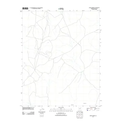
2011 Map of Onion Spring
USGS Topo · Published 2011About this map
Onion Spring and Goat Spring provide critical water sources in this high-desert landscape of Navajo County, which is defined by significant topographic markers and a network of arterial roads. The 2011 survey illustrates a region where land use is dictated by the dramatic natural geography, notably at Coal Point and Meat Point. These prominent landforms overlook an area traversed by several key thoroughfares, including Indian Rte 4, Indian Rte 9, and the Turquoise Trl. This road network indicates the region's importance for local travel and connectivity across the plateau. The placement of these routes and the naming of specific springs offer essential data for researchers tracking the historical and modern navigation of this Arizona landscape.
Find a feature on this map
7 named features on this map. Tap any name to fly to it.
Don’t see what you’re looking for? This feature index may not catch every label — zoom into the map to look around manually.
Map Details
Editions of this 2011 Onion Spring Map
This is the sole edition of this map. No revisions or reprints were ever made.
Other maps of this area

1883 · Marsh Pass
USGS Topo · 1:250,000
1883 · Tusayan
USGS Topo · 1:250,000
1886 · Tusayan
USGS Topo · 1:250,000

1892 · Marsh Pass
USGS Topo · 1:250,000

1947 · Flagstaff
USGS Topo · 1:250,000
1954 · Flagstaff
USGS Topo · 1:250,000

1956 · Marble Canyon
USGS Topo · 1:250,000
1958 · Flagstaff
USGS Topo · 1:250,000

1959 · Marble Canyon
USGS Topo · 1:250,000
1960 · Flagstaff
USGS Topo · 1:250,000