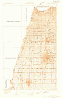
1933 Map of Ontario
USGS Topo · Published 1933About this map
The citrus groves and growing industrial centers of the Inland Empire are captured in detail during the early 1930s. The dense street grid of Ontario and Upland reveals a landscape organized by rail and road, where Foothill Blvd U S Highway No 66 and the Arrow Highway serve as primary east-west arteries. The area's transit heritage is visible through the converging lines of the Pacific Electric, the Atchison Topeka and Santa Fe, and the Southern Pacific railroads, which facilitated the movement of goods from local packing houses and farms.
Find a feature on this map
55 named features on this map. Tap any name to fly to it.
Don’t see what you’re looking for? This feature index may not catch every label — zoom into the map to look around manually.
Map Details
Editions of this 1933 Ontario Map
This is the sole edition of this map. No revisions or reprints were ever made.
Other maps of this area

1894 · Pomona
USGS Topo · 1:62,500

1896 · Anaheim
USGS Topo · 1:62,500

1897 · Pomona
USGS Topo · 1:62,500

1897 · Cucamonga
USGS Topo · 1:62,500

1898 · Pomona
USGS Topo · 1:62,500

1898 · Anaheim
USGS Topo · 1:62,500

1900 · Cucamonga
USGS Topo · 1:62,500

1901 · Southern California Sheet No. 1
USGS Topo · 1:250,000

1901 · Anaheim
USGS Topo · 1:62,500

1902 · Corona
USGS Topo · 1:125,000