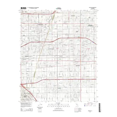
2015 Map of Ontario
USGS Topo · Published 2015About this map
The dense academic landscape of Claremont defines the northwestern corner of this study, featuring an extensive cluster of institutions including Pomona College, Scripps College, and Harvey Mudd College. The map illustrates the suburban expansion of the Pomona Valley, where the grid-like residential developments of Upland and Ontario meet at the Los Angeles Co San Bernardino Co line. This boundary bisects a region characterized by specialized neighborhoods like Narod and Sunsweet, as well as infrastructure like Cable Airport. To the south, the terrain shifts toward the Chino Hills and Puente Hills, where the watercourses of Chino Cr and the San Antonio Cr Channel provide a drainage network for the surrounding communities of Chino and Montclair.
Find a feature on this map
108 named features on this map. Tap any name to fly to it.
Don’t see what you’re looking for? This feature index may not catch every label — zoom into the map to look around manually.
Map Details
Editions of this 2015 Ontario Map
This is the sole edition of this map. No revisions or reprints were ever made.
Other maps of this area

1894 · Pomona
USGS Topo · 1:62,500

1896 · Anaheim
USGS Topo · 1:62,500

1897 · Pomona
USGS Topo · 1:62,500

1897 · Cucamonga
USGS Topo · 1:62,500

1898 · Pomona
USGS Topo · 1:62,500

1898 · Anaheim
USGS Topo · 1:62,500

1900 · Cucamonga
USGS Topo · 1:62,500

1901 · Southern California Sheet No. 1
USGS Topo · 1:250,000

1901 · Anaheim
USGS Topo · 1:62,500

1902 · Corona
USGS Topo · 1:125,000