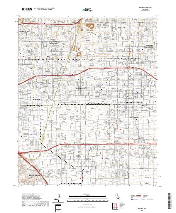
2021 Map of Ontario
USGS Topo · Published 2021About this map
The prestigious academic cluster of Claremont defines the northwestern corner of this study, featuring a concentrated landscape of higher education institutions including Pomona College, Harvey Mudd College, Scripps College, and Pitzer College. This dense suburban and industrial corridor across the Los Angeles and San Bernardino County line reveals a complex network of residential growth and established neighborhoods. The map traces the transition from the foothills of the north down to the established commercial districts of Pomona and Ontario.
Find a feature on this map
91 named features on this map. Tap any name to fly to it.
Don’t see what you’re looking for? This feature index may not catch every label — zoom into the map to look around manually.
Map Details
Editions of this 2021 Ontario Map
This is the sole edition of this map. No revisions or reprints were ever made.
Other maps of this area

1894 · Pomona
USGS Topo · 1:62,500

1896 · Anaheim
USGS Topo · 1:62,500

1897 · Pomona
USGS Topo · 1:62,500
1897 · Cucamonga
USGS Topo · 1:62,500

1898 · Pomona
USGS Topo · 1:62,500

1898 · Anaheim
USGS Topo · 1:62,500
1900 · Cucamonga
USGS Topo · 1:62,500

1901 · Southern California Sheet No. 1
USGS Topo · 1:250,000
1901 · Anaheim
USGS Topo · 1:62,500

1902 · Corona
USGS Topo · 1:125,000