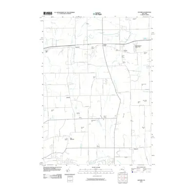
2010 Map of Ontario
USGS Topo · Published 2010About this map
Fruitland and Ontario Center sit along the historic corridor of Ridge Rd, anchoring a landscape defined by its agricultural legacy and early 21st-century residential patterns. This part of Wayne and Monroe counties is punctuated by family-named landmarks and glacial topography, with Mathewson Hill and Negro Hill rising above the surrounding fields and nurseries. Local industry remains visible through sites like Boekhout Farms and Arbor Road Nursery, while the area's deep roots are evidenced by a high density of burial grounds, including the Furnaceville Cemetery and Gould Cemetery. Numerous waterways, such as Fourmile Creek and Bear Creek, drain the territory toward the north, weaving through the small settlements of Union Hill and Lincoln before the terrain meets the lake plain beyond the quadrangle's edge.
Find a feature on this map
58 named features on this map. Tap any name to fly to it.
Don’t see what you’re looking for? This feature index may not catch every label — zoom into the map to look around manually.
Map Details
Editions of this 2010 Ontario Map
This is the sole edition of this map. No revisions or reprints were ever made.
Other maps of this area

1899 · Palmyra
USGS Topo · 1:62,500

1900 · Macedon
USGS Topo · 1:62,500

1902 · Pultneyville
USGS Topo · 1:62,500

1902 · Palmyra
USGS Topo · 1:62,500

1932 · Webster
USGS Topo · 1:24,000

1932 · Fairport
USGS Topo · 1:24,000

1934 · Fairport
USGS Topo · 1:24,000
1934 · Ninemile Point
USGS Topo · 1:24,000

1934 · Webster
USGS Topo · 1:24,000

1942 · Ontario
USGS Topo · 1:31,680