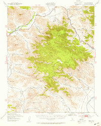
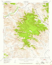
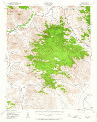
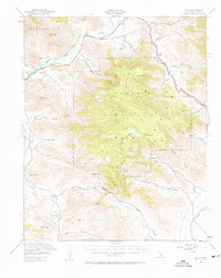
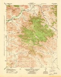
1943 Map of Onyx
USGS Topo · Published 1955About this map
Onyx serves as the focal point for this high-desert landscape in the Sierra Nevada, situated where the South Fork Kern River meets the drainages of Canebrake Creek and Chimney Creek. The map documents a rugged transition zone between mountain peaks and valley floors, notably recording the Cottage Grove Cem and Indian Cem near the riverbanks. Early land use is evident through family-named holdings such as Bloomfield Ranch, Gleason Ranch, and Onyx Ranch, which sit along the established corridors of the Walker Pass Road.
Find a feature on this map
49 named features on this map. Tap any name to fly to it.
Don’t see what you’re looking for? This feature index may not catch every label — zoom into the map to look around manually.
Map Details
Editions of this 1943 Onyx Map
5 editions found
Other maps of this area

1906 · Kernville
USGS Topo · 1:125,000

1908 · Kernville
USGS Topo · 1:125,000

1915 · Searles Lake
USGS Topo · 1:250,000

1915 · Mojave
USGS Topo · 1:125,000
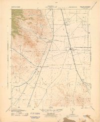
1943 · Inyokern
USGS Topo · 1:62,500
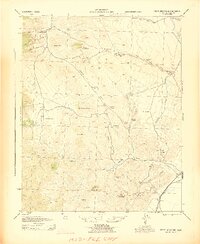
1943 · Cross Mountain
USGS Topo · 1:62,500
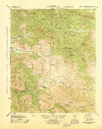
1943 · Emerald Mtn
USGS Topo · 1:62,500
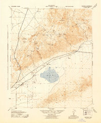
1943 · Saltdale
USGS Topo · 1:62,500
1943 · Onyx
USGS Topo · 1:62,500
1943 · Isabella
USGS Topo · 1:62,500