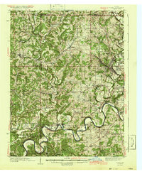
1942 Map of Oolitic
USGS Topo · Published 1942About this map
Stone extraction and rural infrastructure define this portion of the Indiana limestone belt, where the Oolitic and East Oolitic settlements sit adjacent to the sprawling Bedford corporate limits. The landscape is marked by the industrial footprints of the Eureka Quarry, Dark Hollow Quarry, and Needmore Quarry, illustrating the region's importance to the building trades during the early 1940s. Moving west, the terrain transitions into the winding drainage basin of the East Fork White River, featuring prominent river loops like Horseshoe Bend and Henshaw Bend. The map documents a dense network of local landmarks essential for genealogical research, including rural schools like Guthrie Sch and Sulphur Sch, alongside numerous country churches such as Mission Valley Ch and Pleasant Hill Ch. Transportation is anchored by the Monon RR and the Chicago Milwaukee St Paul and Pacific, which served both the quarries and agricultural hubs like Springville and Owensburg.
Find a feature on this map
84 named features on this map. Tap any name to fly to it.
Don’t see what you’re looking for? This feature index may not catch every label — zoom into the map to look around manually.
Map Details
Editions of this 1942 Oolitic Map
2 editions found
Other maps of this area

1908 · Bloomington
USGS Topo · 1:48,000

1908 · Bloomfield
USGS Topo · 1:62,500

1910 · Bloomington
USGS Topo · 1:62,500

1934 · Bedford
USGS Topo · 1:48,000

1935 · Oolitic
USGS Topo · 1:48,000

1937 · Bedford
USGS Topo · 1:62,500

1942 · Franklin
USGS Topo · 1:125,000

1942 · Oolitic
USGS Topo · 1:62,500

1947 · Allens Creek
USGS Topo · 1:24,000

1948 · Huron
USGS Topo · 1:24,000