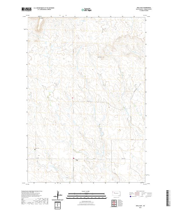
2021 Map of Opal East
USGS Topo · Published 2021About this map
Opal serves as the focal point of this rural Meade County landscape, situated at the intersection of Co HWY MC-35 and Opal Rd. The region is defined by a dendritic drainage network of the Beaver Dam Creek system, including the Middle Br Beaver Dam Cr, E Br Beaver Dam Cr, and W Br Beaver Dam Cr. These seasonal waterways carve through a terrain marked by prominent local elevations such as Fox Ridge in the northwest and Mud Butte in the northeast. For genealogists and local historians, the Backes Cem near 178th Pl provides a specific point of interest for family research. The map illustrates a typical Great Plains section-line road grid, where travel is dictated by routes like Lemon Butte Rd and Twilight Pl, reflecting the enduring structure of South Dakota's ranching and agricultural tracts.
Find a feature on this map
22 named features on this map. Tap any name to fly to it.
Don’t see what you’re looking for? This feature index may not catch every label — zoom into the map to look around manually.
Map Details
Editions of this 2021 Opal East Map
This is the sole edition of this map. No revisions or reprints were ever made.
Other maps of this area

1951 · Maurine
USGS Topo · 1:24,000

1952 · Deep Creek SE
USGS Topo · 1:24,000

1952 · Signal Butte
USGS Topo · 1:24,000

1953 · Rapid City
USGS Topo · 1:250,000

1954 · Lemmon
USGS Topo · 1:250,000

1957 · Lemmon
USGS Topo · 1:250,000

1957 · Rapid City
USGS Topo · 1:250,000

1983 · Opal West SE
USGS Topo · 1:24,000

1983 · Lemmon Butte
USGS Topo · 1:24,000
1983 · Opal East
USGS Topo · 1:24,000