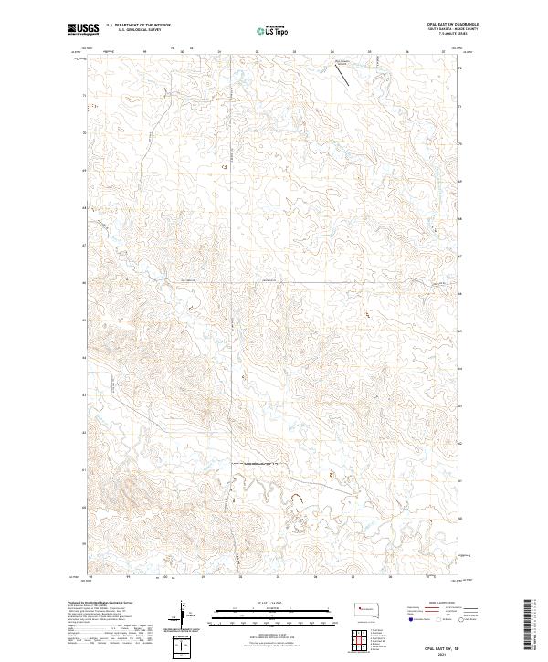
2021 Map of Opal East SW
USGS Topo · Published 2021About this map
Vig Limousin Airport stands as a distinct human marker in this expansive Meade County landscape, where the drainage patterns of the northern Great Plains dictate the terrain. The hydrology is dominated by the seasonal paths of Beaver Dam Cr and its tributaries, including Middle Br Beaver Dam Cr and W Br Beaver Dam Cr. These waterways, along with Sulphur Cr and Elm Cr, have carved intricate coulees into the high plains. A grid of section roads and cattle-country routes like Fox Ridge Rd, Pine Creek Rd, and Grapevine Rd provide the primary infrastructure through the townships of t10n r14e and t11n r14e. This survey captures the sparse ranching environment of western South Dakota, defined by its watercourses and long-distance section lines.
Find a feature on this map
21 named features on this map. Tap any name to fly to it.
Don’t see what you’re looking for? This feature index may not catch every label — zoom into the map to look around manually.
Map Details
Editions of this 2021 Opal East SW Map
This is the sole edition of this map. No revisions or reprints were ever made.
Other maps of this area

1953 · Rapid City
USGS Topo · 1:250,000

1957 · Rapid City
USGS Topo · 1:250,000

1959 · Redowl
USGS Topo · 1:24,000

1983 · Whiteman Owl NW
USGS Topo · 1:24,000

1983 · Opal West SE
USGS Topo · 1:24,000

1983 · Lemmon Butte
USGS Topo · 1:24,000
1983 · Opal East
USGS Topo · 1:24,000

1983 · Opal East SW
USGS Topo · 1:24,000

1983 · Marcus
USGS Topo · 1:24,000
1983 · Opal East SE
USGS Topo · 1:24,000