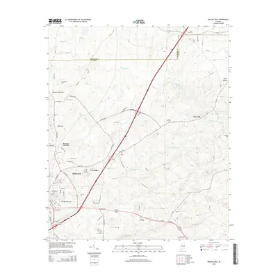
2014 Map of Opelika East
USGS Topo · Published 2014About this map
The eastern reaches of Opelika and the surrounding Lee County landscape are defined by a network of creeks and small, established communities. Residential areas like West Ridge and Crooked Creek sit alongside the rail-associated Roanoke Junction, reflecting the area's growth patterns near the Georgia border. The terrain is drained by several branches of Halawake Cr and Little Halawake Cr, where the local economy was once anchored by sites like Beans Mill.
Find a feature on this map
96 named features on this map. Tap any name to fly to it.
Don’t see what you’re looking for? This feature index may not catch every label — zoom into the map to look around manually.
Map Details
Editions of this 2014 Opelika East Map
This is the sole edition of this map. No revisions or reprints were ever made.
Other maps of this area

1907 · Opelika
USGS Topo · 1:125,000

1909 · Opelika
USGS Topo · 1:125,000

1955 · Phenix City
USGS Topo · 1:250,000

1957 · Phenix City
USGS Topo · 1:250,000

1958 · Phenix City
USGS Topo · 1:250,000

1964 · Lanett South
USGS Topo · 1:24,000
1965 · Bleecker
USGS Topo · 1:24,000
1965 · Beulah
USGS Topo · 1:24,000

1970 · Opelika East
USGS Topo · 1:24,000

1971 · Parkers Crossroads
USGS Topo · 1:24,000