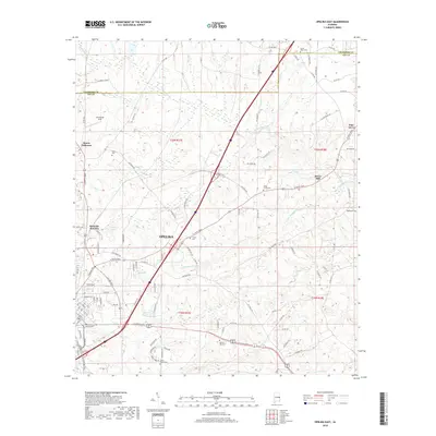
2018 Map of Opelika East
USGS Topo · Published 2018About this map
Opelika and its eastern surroundings in Lee County are captured here as the city's residential and industrial footprint interacts with established rural landmarks. The landscape is defined by the drainage basins of Halawakee Creek and Little Halawakee Creek, which cut through the undulating terrain north and east of the city center. Several historical focal points for local genealogy appear, including Liberty Cem, Sweet Hope Cem, and Hephzibah Cem.
Find a feature on this map
103 named features on this map. Tap any name to fly to it.
Don’t see what you’re looking for? This feature index may not catch every label — zoom into the map to look around manually.
Map Details
Editions of this 2018 Opelika East Map
This is the sole edition of this map. No revisions or reprints were ever made.
Other maps of this area

1907 · Opelika
USGS Topo · 1:125,000

1909 · Opelika
USGS Topo · 1:125,000

1955 · Phenix City
USGS Topo · 1:250,000

1957 · Phenix City
USGS Topo · 1:250,000

1958 · Phenix City
USGS Topo · 1:250,000

1964 · Lanett South
USGS Topo · 1:24,000
1965 · Bleecker
USGS Topo · 1:24,000
1965 · Beulah
USGS Topo · 1:24,000

1970 · Opelika East
USGS Topo · 1:24,000

1971 · Parkers Crossroads
USGS Topo · 1:24,000