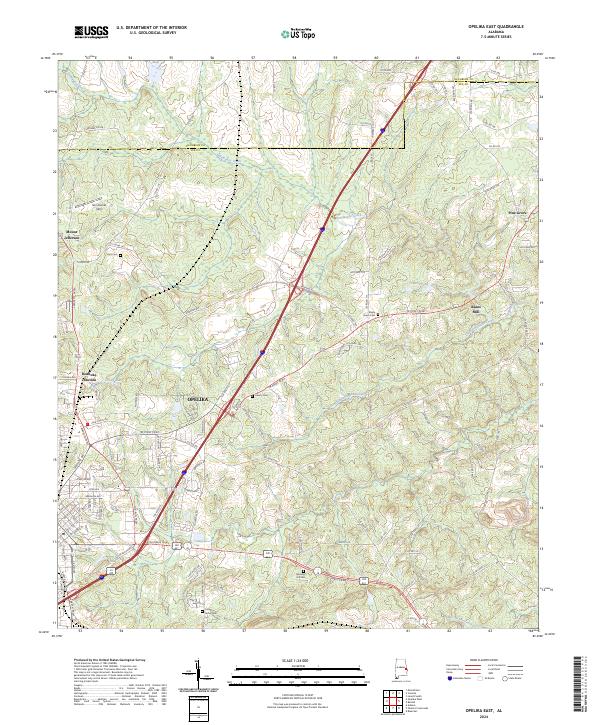
2024 Map of Opelika East
USGS Topo · Published 2024About this map
Opelika serves as the focal point for this eastern Alabama landscape, where the urban street grid of the county seat gives way to the drainage basins of Halawake Creek and Little Halawake Creek. The map captures the meeting of several historical neighborhoods and small outlying communities, including Roanoke Junction and Mount Jefferson. A significant concentration of family and community resting places, such as Memory Hill Cem and Union Grove Cem, are scattered throughout the rural-to-urban transition zone, providing valuable data points for local genealogists and historians.
Find a feature on this map
107 named features on this map. Tap any name to fly to it.
Don’t see what you’re looking for? This feature index may not catch every label — zoom into the map to look around manually.
Map Details
Editions of this 2024 Opelika East Map
This is the sole edition of this map. No revisions or reprints were ever made.
Other maps of this area

1907 · Opelika
USGS Topo · 1:125,000

1909 · Opelika
USGS Topo · 1:125,000

1955 · Phenix City
USGS Topo · 1:250,000

1957 · Phenix City
USGS Topo · 1:250,000

1958 · Phenix City
USGS Topo · 1:250,000

1964 · Lanett South
USGS Topo · 1:24,000
1965 · Bleecker
USGS Topo · 1:24,000
1965 · Beulah
USGS Topo · 1:24,000

1970 · Opelika East
USGS Topo · 1:24,000

1971 · Parkers Crossroads
USGS Topo · 1:24,000