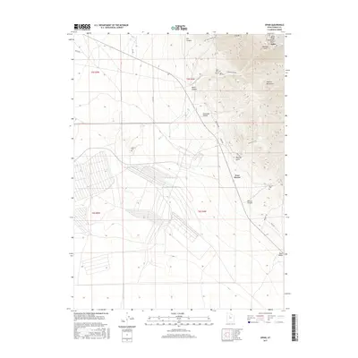
2017 Map of Ophir
USGS Topo · Published 2017About this map
Ophir and the surrounding Oquirrh Mountains are defined by a complex history of resource extraction and high-altitude settlement. This 2017 study illustrates the legacy of the region through its preserved burial grounds and mining-related infrastructure. The map tracks the steep descent from Dry Mtn and Lynch Ridge down into the narrow corridors of Ophir Canyon and Mercur Canyon. For genealogists and local historians, the location of the Ophir Old Cem, Ophir New Cem, and the Mercur Cem provides a vital link to the miners and families who once populated these canyons. The landscape transitions from the high peaks into the broad expanse of Rush Valley, where roads such as the Dry Canyon Mining Rd and Prospect Rd highlight the enduring footprint of industrial exploration in Tooele County.
Find a feature on this map
33 named features on this map. Tap any name to fly to it.
Don’t see what you’re looking for? This feature index may not catch every label — zoom into the map to look around manually.
Map Details
Editions of this 2017 Ophir Map
This is the sole edition of this map. No revisions or reprints were ever made.
Other maps of this area

1885 · Tooele Valley
USGS Topo · 1:250,000

1915 · Fairfield
USGS Topo · 1:62,500

1917 · Fairfield
USGS Topo · 1:62,500

1918 · Stockton
USGS Topo · 1:62,500

1947 · Fivemile Pass
USGS Topo · 1:62,500

1949 · Fivemile Pass
USGS Topo · 1:24,000

1953 · Tooele
USGS Topo · 1:250,000

1955 · Stockton
USGS Topo · 1:62,500

1955 · Tooele
USGS Topo · 1:250,000
1968 · Mercur
USGS Topo · 1:24,000