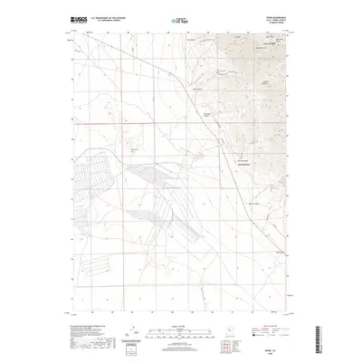
2020 Map of Ophir
USGS Topo · Published 2020About this map
The Town of Ophir is set deep within Ophir Canyon on the western slopes of the Oquirrh Mountains. This 2020 survey illustrates the complex geography of this historic mining district, where narrow drainages like Silverado Canyon and Hartmann Gulch converge. The legacy of the area's extraction history is visible in the rugged road network, including the Dry Canyon Mining Rd and Prospect Rd.
Find a feature on this map
27 named features on this map. Tap any name to fly to it.
Don’t see what you’re looking for? This feature index may not catch every label — zoom into the map to look around manually.
Map Details
Editions of this 2020 Ophir Map
This is the sole edition of this map. No revisions or reprints were ever made.
Other maps of this area

1885 · Tooele Valley
USGS Topo · 1:250,000

1915 · Fairfield
USGS Topo · 1:62,500

1917 · Fairfield
USGS Topo · 1:62,500

1918 · Stockton
USGS Topo · 1:62,500

1947 · Fivemile Pass
USGS Topo · 1:62,500

1949 · Fivemile Pass
USGS Topo · 1:24,000

1953 · Tooele
USGS Topo · 1:250,000

1955 · Stockton
USGS Topo · 1:62,500

1955 · Tooele
USGS Topo · 1:250,000
1968 · Mercur
USGS Topo · 1:24,000