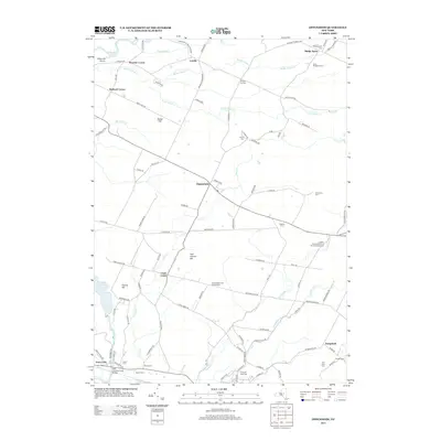
2013 Map of Oppenheim
USGS Topo · Published 2013About this map
The Adirondack Park Preserve boundary skirts the northern edge of this landscape, where the town of Oppenheim serves as a central hub for a network of rural roads and waterways. The geography is defined by the southward flow of Crum Cr and Timmerman Cr, which carve through the terrain between heights like Sweet Hill and Twin Church Hill. Numerous small family and denominational burial grounds, such as Saint Bridgett's Cem and the Dutch Reformed Church Cem, are scattered across the township, offering significant touchpoints for genealogical research in Herkimer County.
Find a feature on this map
118 named features on this map. Tap any name to fly to it.
Don’t see what you’re looking for? This feature index may not catch every label — zoom into the map to look around manually.
Map Details
Editions of this 2013 Oppenheim Map
This is the sole edition of this map. No revisions or reprints were ever made.
Other maps of this area

1898 · Canajoharie
USGS Topo · 1:62,500

1900 · Little Falls
USGS Topo · 1:62,500

1900 · Canajoharie
USGS Topo · 1:62,500

1901 · Lassellsville
USGS Topo · 1:62,500

1902 · Canajoharie
USGS Topo · 1:62,500

1903 · Richfield Springs
USGS Topo · 1:62,500

1903 · Lassellsville
USGS Topo · 1:62,500

1903 · Little Falls
USGS Topo · 1:62,500

1939 · Little Falls
USGS Topo · 1:62,500
1943 · Little Falls
USGS Topo · 1:24,000