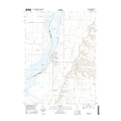
2015 Map of Oquawka
USGS Topo · Published 2015About this map
Oquawka sits at a strategic bend in the Mississippi River, serving as a focal point for this borderland between Illinois and Iowa. The landscape is defined by the shifting waters of the river, which creates a complex network of side channels and islands including Benton Island, Mill Island, and Oquawka Island. To the north, Delabar State Park preserves a section of the riverbank, while the inland areas are marked by significant local history sites such as the Oquawka Wagon Covered Bridge. The terrain transitions from the low-lying river bottomlands and sloughs like Phelps Slough to the higher elevations east of the town where Jinks Hollow carves into the bluffs. Genealogists may find value in the documentation of several local burial grounds, including the Oquawka Cemetery and the County Farm Cemetery, which reflect the long-standing community structure of Henderson County.
Find a feature on this map
60 named features on this map. Tap any name to fly to it.
Don’t see what you’re looking for? This feature index may not catch every label — zoom into the map to look around manually.
Map Details
Editions of this 2015 Oquawka Map
This is the sole edition of this map. No revisions or reprints were ever made.
Other maps of this area

1934 · Oquawka
USGS Topo · 1:48,000

1934 · Burlington
USGS Topo · 1:48,000

1935 · Keithsburg
USGS Topo · 1:48,000

1940 · Oquawka
USGS Topo · 1:62,500

1940 · Burlington
USGS Topo · 1:62,500

1941 · Keithsburg
USGS Topo · 1:62,500

1946 · Wapello
USGS Topo · 1:62,500

1949 · Wapello
USGS Topo · 1:62,500

1958 · Burlington
USGS Topo · 1:250,000

1958 · Davenport
USGS Topo · 1:250,000