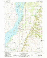
1982 Map of Oquawka
USGS Topo · Published 1983About this map
Oquawka serves as the focal point along the eastern bank of the Mississippi River, where the town's street grid meets a complex network of side channels and islands. This 1982 landscape is defined by the shifting waters of the river valley, which has created a series of distinct terrain features such as Oquawka Island, Long Island, and Furnald Island. To the north, Delabar State Park and the Big River State Forest preserve a significant portion of the riverfront, while the interior is marked by the winding path of Henderson Creek and its tributary, Smith Creek. For those interested in local history, the map identifies specific landmarks like the Covered Bridge and the County Farm Cem. The transition from the flat river bottoms near Meekers Landing to the higher elevations of Bald Bluff illustrates the varied topography of this section of Henderson County.
Find a feature on this map
43 named features on this map. Tap any name to fly to it.
Don’t see what you’re looking for? This feature index may not catch every label — zoom into the map to look around manually.
Map Details
Editions of this 1982 Oquawka Map
This is the sole edition of this map. No revisions or reprints were ever made.
Other maps of this area

1934 · Oquawka
USGS Topo · 1:48,000

1934 · Burlington
USGS Topo · 1:48,000

1935 · Keithsburg
USGS Topo · 1:48,000

1940 · Oquawka
USGS Topo · 1:62,500

1940 · Burlington
USGS Topo · 1:62,500

1941 · Keithsburg
USGS Topo · 1:62,500

1946 · Wapello
USGS Topo · 1:62,500

1949 · Wapello
USGS Topo · 1:62,500

1958 · Burlington
USGS Topo · 1:250,000

1958 · Davenport
USGS Topo · 1:250,000