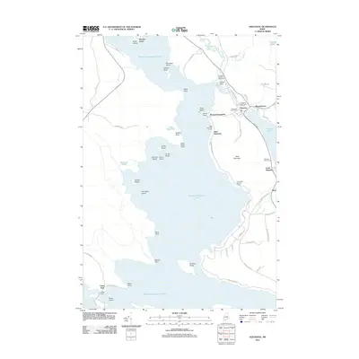
2011 Map of Oquossoc
USGS Topo · Published 2011About this map
Mooselookmeguntic Lake dominates this landscape, its waters dotted with numerous named islands including Students Island, Griffin Island, and Farrington Island. The settlement of Oquossoc serves as a central hub, situated near the Oquossoc Post Office and the Rangeley Lake Dam where the Rangeley River begins its short course. The map documents a well-established sporting and recreational infrastructure, notably the Oquossoc Angling Association and various retreats like the Bald Mountain Camps and Clear Water Sporting Camps.
Find a feature on this map
65 named features on this map. Tap any name to fly to it.
Don’t see what you’re looking for? This feature index may not catch every label — zoom into the map to look around manually.
Map Details
Editions of this 2011 Oquossoc Map
This is the sole edition of this map. No revisions or reprints were ever made.
Other maps of this area

1931 · Cupsuptic
USGS Topo · 1:48,000

1932 · Kennebago Lake
USGS Topo · 1:48,000

1933 · Rangeley
USGS Topo · 1:48,000

1934 · Cupsuptic
USGS Topo · 1:62,500

1935 · Kennebago Lake
USGS Topo · 1:62,500

1935 · Cupsuptic
USGS Topo · 1:62,500

1936 · Kennebago Lake
USGS Topo · 1:62,500

1939 · Rangeley
USGS Topo · 1:62,500

1940 · Oquossoc
USGS Topo · 1:62,500

1942 · Oquossoc
USGS Topo · 1:62,500
Featured Places
- Rangeley, ME
- Rangeley Plantation, ME
- Adamstown Township, ME
- Upper Dam, Richardsontown Township
- Richardsontown Township, ME