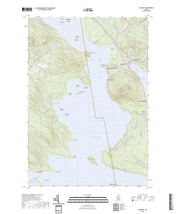
2024 Map of Oquossoc
USGS Topo · Published 2024About this map
Mooselookmeguntic Lake dominates this Western Maine landscape, serving as a central hub for the interconnected waterways and settlements of the Rangeley Lakes region. The 2024 survey captures a high-resolution view of the local shoreline and islands, including Students Island and Shelter Island, alongside the transition between Oxford and Franklin counties. Historically significant locations like Upper Dam and Oquossoc are clearly marked, illustrating how the natural topography of Bald Mountain and surrounding peaks has dictated the placement of camps and small settlements. The drainage network is complex, featuring the Kennebago River and Rangeley River flowing between larger basins. Local history is preserved in the naming of remote points and coves, such as Brandy Point and Sandy Cove, which have long been destinations for outdoor recreation and wilderness retreats.
Find a feature on this map
80 named features on this map. Tap any name to fly to it.
Don’t see what you’re looking for? This feature index may not catch every label — zoom into the map to look around manually.
Map Details
Editions of this 2024 Oquossoc Map
This is the sole edition of this map. No revisions or reprints were ever made.
Other maps of this area

1931 · Cupsuptic
USGS Topo · 1:48,000

1932 · Kennebago Lake
USGS Topo · 1:48,000

1933 · Rangeley
USGS Topo · 1:48,000

1934 · Cupsuptic
USGS Topo · 1:62,500

1935 · Kennebago Lake
USGS Topo · 1:62,500

1935 · Cupsuptic
USGS Topo · 1:62,500

1936 · Kennebago Lake
USGS Topo · 1:62,500

1939 · Rangeley
USGS Topo · 1:62,500

1940 · Oquossoc
USGS Topo · 1:62,500

1942 · Oquossoc
USGS Topo · 1:62,500
Featured Places
- Rangeley, ME
- Rangeley Plantation, ME
- Adamstown Township, ME
- Richardsontown Township, ME
- Pleasant Island, Adamstown Township