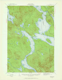
1940 Map of Oquossoc
USGS Topo · Published 1961About this map
The Rangeley Lake region of Oxford County centers on a vast network of interconnected waters, including Cupsuptic Lake and the sprawling Mooselookmeguntic Lake. In the mid-twentieth century, these waters were managed by significant engineering works like Upper Dam and Middle Dam, which controlled the flow between the larger basins. The settlement of Oquossoc serves as a hub for the area, located near Indian Rock and the Kennebago River inlet.
Find a feature on this map
121 named features on this map. Tap any name to fly to it.
Don’t see what you’re looking for? This feature index may not catch every label — zoom into the map to look around manually.
Map Details
Editions of this 1940 Oquossoc Map
4 editions found

Other maps of this area

1927 · Rumford
USGS Topo · 1:48,000

1927 · Second Lake
USGS Topo · 1:62,500

1930 · Rumford
USGS Topo · 1:62,500

1930 · Milan
USGS Topo · 1:62,500

1930 · Errol
USGS Topo · 1:62,500

1931 · Cupsuptic
USGS Topo · 1:48,000

1932 · Kennebago Lake
USGS Topo · 1:48,000

1932 · Second Lake
USGS Topo · 1:62,500

1933 · Rangeley
USGS Topo · 1:48,000

1933 · Milan
USGS Topo · 1:62,500