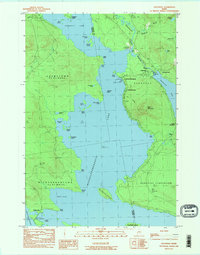
1984 Map of Oquossoc
USGS Topo · Published 1985About this map
Oquossoc sits at the northern neck where the Kennebago River meets the expansive waters of Mooselookmeguntic Lake. This mid-1980s survey captures a landscape defined by its timber and sporting traditions, evidenced by the presence of the Oquossoc Angling Assn and the Rangeley Grade corridor. The geography is characterized by an intricate network of interconnected waterways, including Cupsuptic Lake and Upper Richardson Lake, which are regulated by infrastructure like the Upper Dam.
Find a feature on this map
49 named features on this map. Tap any name to fly to it.
Don’t see what you’re looking for? This feature index may not catch every label — zoom into the map to look around manually.
Map Details
Editions of this 1984 Oquossoc Map
2 editions found
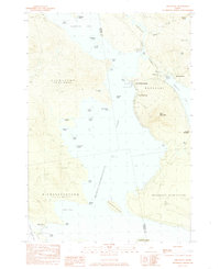
Other maps of this area

1931 · Cupsuptic
USGS Topo · 1:48,000

1932 · Kennebago Lake
USGS Topo · 1:48,000

1933 · Rangeley
USGS Topo · 1:48,000

1934 · Cupsuptic
USGS Topo · 1:62,500

1935 · Kennebago Lake
USGS Topo · 1:62,500

1935 · Cupsuptic
USGS Topo · 1:62,500

1936 · Kennebago Lake
USGS Topo · 1:62,500

1939 · Rangeley
USGS Topo · 1:62,500

1940 · Oquossoc
USGS Topo · 1:62,500

1942 · Oquossoc
USGS Topo · 1:62,500
Featured Places
- Rangeley, ME
- Rangeley Plantation, ME
- Adamstown Township, ME
- Upper Dam, Richardsontown Township
- Pleasant Island, Adamstown Township