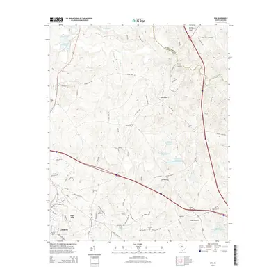
2014 Map of Ora
USGS Topo · Published 2014About this map
Laurens and its northeastern rural surroundings are captured in this study of the Upstate landscape, where the urban edge of Watts Mills and Wattsville transitions into the rolling watershed of Duncan Cr. The map documents a cluster of small settlements and transit hubs, from the crossroads at Tylersville and Goodwins Crossroads to the aviation facilities at the Laurens County Airport. Local genealogy is well-served by the inclusion of several burial grounds, including Sandy Springs Cem and Langston Cem, which are tucked away along the network of country roads. Water management is a visible priority across the terrain, evidenced by the Old Clinton Reservoir and the Duncan Creek Watershed Number 6b Reservoir, reflecting the region's hydraulic development for recreation and resource protection.
Find a feature on this map
100 named features on this map. Tap any name to fly to it.
Don’t see what you’re looking for? This feature index may not catch every label — zoom into the map to look around manually.
Map Details
Editions of this 2014 Ora Map
This is the sole edition of this map. No revisions or reprints were ever made.
Other maps of this area

1892 · Abbeville
USGS Topo · 1:125,000

1941 · Spartanburg
USGS Topo · 1:250,000

1953 · Spartanburg
USGS Topo · 1:250,000

1954 · Greenville
USGS Topo · 1:250,000

1957 · Fountain Inn
USGS Topo · 1:62,500

1958 · Greenville
USGS Topo · 1:250,000

1960 · Spartanburg
USGS Topo · 1:250,000

1963 · Spartanburg
USGS Topo · 1:250,000

1964 · Spartanburg
USGS Topo · 1:250,000

1969 · Cross Anchor
USGS Topo · 1:24,000