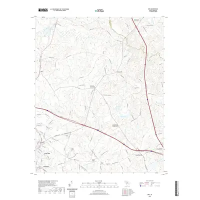
2020 Map of Ora
USGS Topo · Published 2020About this map
Laurens and Clinton anchor the southwestern and southeastern corners of this Piedmont landscape, connected by a network of rural routes and the Interstate corridor. The geography is defined by the descent of Duncan Creek and the Enoree River, which forms a portion of the northern boundary between Laurens Co and Spartanburg Co. This 2020 map documents the transition from the industrial outskirts of Watts Mills and Wattsville to the agricultural reaches of Tylersville and Goodwins Crossroads. Local history and genealogy researchers will find several significant burial grounds, including the Sandy Springs United Methodist Church Graveyard and the Langston Cem, alongside notable infrastructure like the Laurens County Airport. Smaller settlements such as Ora and Long Branch are interspersed among the drainages of Warrior Cr and Buckhead Cr, reflecting a long-standing settlement pattern tied to the region's numerous small watercourses.
Find a feature on this map
110 named features on this map. Tap any name to fly to it.
Don’t see what you’re looking for? This feature index may not catch every label — zoom into the map to look around manually.
Map Details
Editions of this 2020 Ora Map
This is the sole edition of this map. No revisions or reprints were ever made.
Other maps of this area

1892 · Abbeville
USGS Topo · 1:125,000

1941 · Spartanburg
USGS Topo · 1:250,000

1953 · Spartanburg
USGS Topo · 1:250,000

1954 · Greenville
USGS Topo · 1:250,000

1957 · Fountain Inn
USGS Topo · 1:62,500

1958 · Greenville
USGS Topo · 1:250,000

1960 · Spartanburg
USGS Topo · 1:250,000

1963 · Spartanburg
USGS Topo · 1:250,000

1964 · Spartanburg
USGS Topo · 1:250,000

1969 · Cross Anchor
USGS Topo · 1:24,000