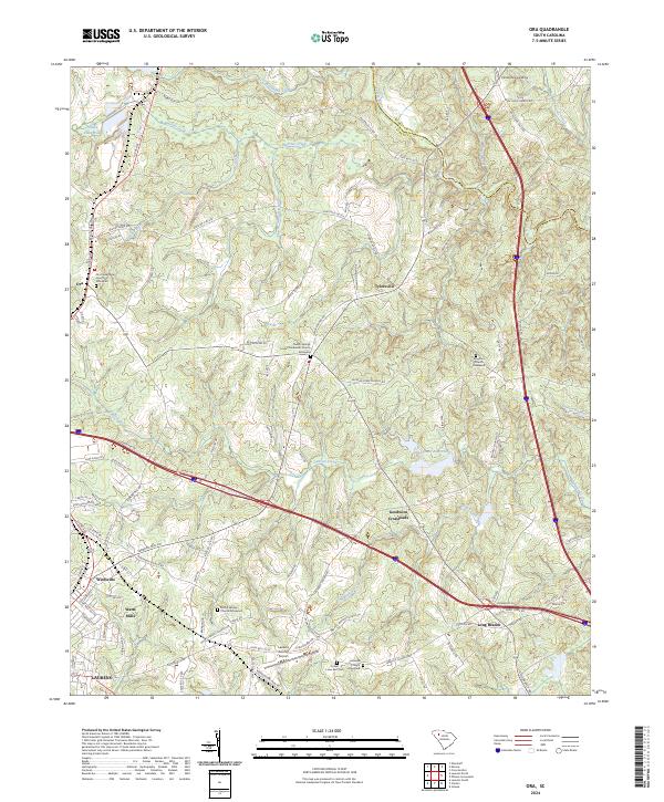
2024 Map of Ora
USGS Topo · Published 2024About this map
Watts Mills and the adjacent community of Wattsville anchor the southwestern portion of this landscape, reflecting the textile manufacturing heritage of the Piedmont. The area's spiritual and genealogical history is deeply etched into the countryside through numerous rural congregations and their associated burial grounds, such as the Ora Presbyterian Church Graveyard and the Sandy Springs United Methodist Church Graveyard. North of Laurens, the topography is defined by the winding course of the Enoree River, which forms the boundary between Laurens and Spartanburg counties. The presence of the Laurens County Airport and the Old Clinton Reservoir indicates modern infrastructure transitions among traditional settlements like Tylersville and Goodwins Crossroads. This survey documents a region where historic family names persist on roads and church registers, from Long Branch to the northern reaches of Warrior Creek.
Find a feature on this map
107 named features on this map. Tap any name to fly to it.
Don’t see what you’re looking for? This feature index may not catch every label — zoom into the map to look around manually.
Map Details
Editions of this 2024 Ora Map
This is the sole edition of this map. No revisions or reprints were ever made.
Other maps of this area

1892 · Abbeville
USGS Topo · 1:125,000

1941 · Spartanburg
USGS Topo · 1:250,000

1953 · Spartanburg
USGS Topo · 1:250,000

1954 · Greenville
USGS Topo · 1:250,000

1957 · Fountain Inn
USGS Topo · 1:62,500

1958 · Greenville
USGS Topo · 1:250,000

1960 · Spartanburg
USGS Topo · 1:250,000

1963 · Spartanburg
USGS Topo · 1:250,000

1964 · Spartanburg
USGS Topo · 1:250,000

1969 · Cross Anchor
USGS Topo · 1:24,000